

Residents of Guelph have likely observed trucks that resemble Google Street View vehicles in recent weeks, equipped with large cameras driving through neighborhoods. These trucks are on a mission to gather millions of laser measurements of trees lining the streets to develop a detailed three-dimensional virtual map of the city’s tree inventory. This initiative aims to enhance the management of the city’s tree population and work towards achieving a 40% tree canopy cover by 2070, as stated by Dave Beaton, the program manager for forestry and sustainable landscapes in Guelph.
According to Beaton, the current tree inventory in Guelph is approximately 12 years old and has become outdated due to the growth, removal, and new plantings of trees. The new system will offer a more precise update by capturing detailed information about urban trees, enabling better planning not just for the immediate future but also for the long term.
Creating a Digital City Model
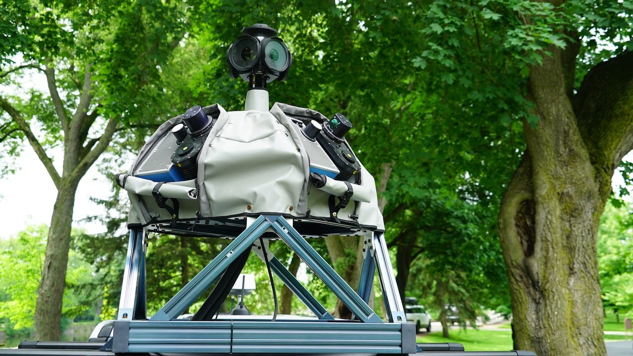
The trucks are outfitted with mobile LiDAR scanners that meticulously capture measurements of trees, including height, trunk diameter, canopy size, and location as they traverse neighborhoods. Additionally, these vehicles gather data about nearby infrastructure such as signs and hydrants. The project is a collaboration with Jakarto, a Quebec-based mapping company.
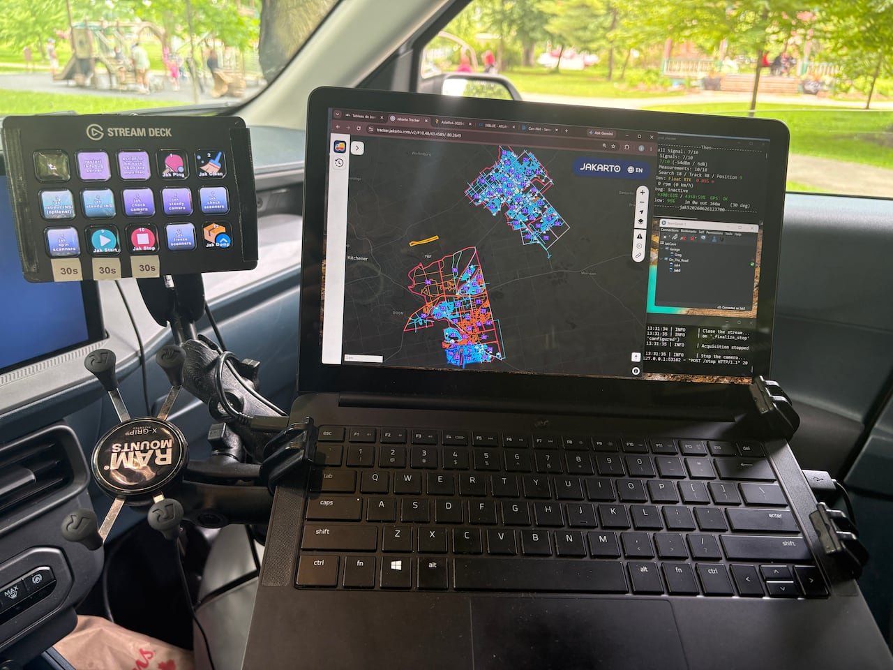
Jakarto’s founder and CEO, Felix LaRoche, mentioned that they have executed similar projects in Cambridge and Burlington, emphasizing that they collect two million measurements per second while driving to produce an extremely accurate digital twin.
The data collected by these scanning trucks is limited to what is visible from public roads and does not intrude on private property. Before being accessed by municipal staff, license plates are automatically blurred for privacy. This data will aid in identifying tree planting opportunities, enhancing long-term planning, and targeting areas with insufficient canopy cover.
Beaton anticipates that within two months, Guelph will possess an updated inventory and a 3D virtual map of the city’s urban trees and public infrastructure. He highlighted that this process would have been significantly more time-consuming using traditional methods that involved extensive driving and manual data collection.
Expanding Beyond Trees
The digital twin, or map, serves as a sophisticated virtual model of the city, providing detailed insights into the urban environment. LaRoche described it as a replica of the city, akin to Google Street View but with additional tools, enabling city staff to conduct measurements and inspect infrastructure digitally without physical fieldwork.
Beaton emphasized the map’s potential for asset management across various city departments, offering an efficient way to visualize and manage city resources. In Cambridge, a similar technology is being applied for planning and development decisions.
Hardy Bromberg, the general manager of planning and growth in Cambridge, noted that the city is enhancing existing aerial 3D mapping data with new street-level scans to create an advanced virtual model. This detailed model will assist in visualizing proposed developments within neighborhood contexts, aiming to expedite development proposals and enhance public awareness.</